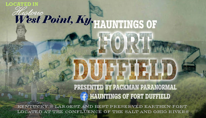
FORT DUFFIELD
A Civil War Legacy
Walk the trails, learn about its significance, and experience living history programs
that bring the past to life.
Fort Duffield at the Mouth of Salt River
Fort Duffield Park and Historic Site spans 175 acres in North Hardin County, Kentucky. Once part of the
Fort Knox military reservation, the land was transferred to the City of West Point in 1978 through the
National Park Service’s Lands‑to‑Parks Program, ensuring its preservation for public recreation.
Kentucky’s Largest Earthen Civil War Fort
The fort sits atop historic Pearman Hill, rising nearly 300 feet above West Point. It is Kentucky’s largest
and best‑preserved Civil War earthen fortification, recognized as a Kentucky Landmark and listed on the
Civil War Discovery Trail.
Strategic Importance During the Civil War
In late 1861 and throughout 1862, West Point became a critical Union staging area. Supplies from Louisville
were shipped by steamboat down the Ohio River and offloaded at West Point, where wagons carried them south
to training camps and advancing Union forces.
Regiments from Indiana, Ohio, Wisconsin, and Michigan passed through West Point on their way south. The 9th
Michigan Volunteer Infantry constructed Fort Duffield and built a wooden bridge across the Salt River,
improving troop and supply movement.
Securing Kentucky for the Union
President Abraham Lincoln insisted that “I must have Kentucky,” and Fort Duffield’s commanding position above
the confluence of the Salt and Ohio Rivers helped secure that goal. With no railroad passing through West
Point at the time, General Sherman recognized the need to protect both land and water routes essential to
Union operations.
After the War
Following the Battle of Perryville in 1862, the war shifted south. Artillery and munitions were removed from
Fort Duffield in December, and the fort was left largely undisturbed except for occasional guerrilla activity.
Though never challenged in battle, its strategic position played a meaningful role in the Union’s early efforts
to hold Kentucky.


Civil War Camps & Forts of Hardin County
Select a camp or fort to view its full history and modern map location.
Fort Duffield — A Civil War Legacy
Fort Duffield is Kentucky’s largest and best‑preserved Civil War earthen fortification. Built in November and
December of 1861 by the 9th Michigan Infantry, the fort protected the confluence of the Salt and Ohio Rivers
and the vital Louisville & Nashville Turnpike supply route. Its commanding position atop Pearman Hill allowed
Union forces to secure transportation corridors essential to the war effort.
Units Stationed at Fort Duffield
- 9th Michigan Infantry — primary builders of the fort and Salt River bridge
- 37th Indiana Infantry — assisted in construction
- 1st & 18th Ohio Infantry — Camp Armstrong
- 1st Wisconsin Infantry — Camp Buell
- Batteries F & G, 1st Michigan Light Artillery
- Company C, 28th Kentucky Infantry — later decommissioned the fort
Timeline
- Oct 28, 1861 — 9th Michigan arrives at West Point
- Nov 3 — Ordered to build Fort Duffield
- Nov–Dec — Daily construction; sickness spreads
- Jan 1, 1862 — Fort completed
- Dec 1862 — Fort decommissioned
Modern Location
Pearman Hill, West Point, Kentucky — Fort Duffield Trailhead
Camp Haycraft — Elizabethtown, Kentucky
Camp Haycraft was one of the earliest and most active Union encampments in Hardin County during the Civil War.
Located on the southeast side of Elizabethtown, the camp sat on the hill once occupied by the pioneer-era
Fort Haycraft. Today, the Greenbelt Trail passes directly through the historic site.
Location & Modern Landmark
The camp’s location is marked along the Greenbelt Trail. The trail begins across from the Justice Center at
Valley Creek Bridge and continues east for roughly three‑quarters of a mile. Signs mark the site of both the
pioneer fort and the Civil War encampment.
Regiments at Camp Haycraft
- 18th Ohio Infantry — November 1861; described the camp as “beautiful & healthy.” Brigaded with the 37th Indiana and 19th Illinois under Col. John Basil Turchin.
- 19th Illinois Infantry — December 1861.
- Kentucky Troops — February 13, 1862 (Louisville Daily Journal).
- 9th Michigan Infantry — January 4 to March 12, 1862; guarded bridges and moved between Nolin Bridge and West Point.
- 37th Indiana Infantry — Present during early movements.
- 124th Ohio Infantry — Documented in the Haycraft diary.
Life at Camp Haycraft
Letters and diaries describe troops camping directly on the Haycraft farm. The 124th Ohio camped on the lawn,
while Indiana cavalry encamped in the orchard. Soldiers drilled daily, marched frequently, and practiced firing
their muskets. On December 18, 1861, the brigade left Camp Haycraft for Camp Stanton, seven miles down the road.
Michigan Soldiers Who Died at Camp Haycraft
These soldiers of the 9th Michigan Infantry died while stationed at Elizabethtown:
- Lambert Barshite — Co. B — Feb. 19, 1862
- Augustus Bessee — Co. B — June 24, 1862
- Alexander Frazier — Co. D — April 1862
- Newton D. Hadden — Co. F — Feb. 8, 1862
- Cyrus Hill — Co. F — Mar. 15, 1862
- Ben Hodgekiss — Co. G — Mar. 12, 1862
- Joseph H. Lott — Co. B — Mar. 16, 1862 (typhoid)
- Melvin Munson — Co. K — Feb. 22, 1862
- Milton W. Sawyer — Co. K — Feb. 22, 1862
- Henry Shook — Co. B — Mar. 8, 1862
- William H. Sibley — Co. A — Jan. 25, 1862
- Solomon Sutton — Co. D — Feb. 24, 1862
- George Varnum — Co. D — Mar. 17, 1862
- James David Hastings — 37th Indiana — Dec. 5, 1861 (typhoid)
Camp Hazard — West Point, Kentucky
Camp Hazard was one of the Union encampments established near West Point during the fall of 1861. Although
its exact boundaries are not fully documented, records consistently place the camp on the Hardin County side
of the Salt River, forming part of the larger West Point military complex that supported the construction and
defense of Fort Duffield.
Location & Modern Landmark
Camp Hazard was located along the Ohio River flats west of downtown West Point. Modern reference points place
the camp approximately 300–500 yards west of today’s Ohio River boat ramp at Veterans Memorial Park. The area
consists of open fields between the levee road and the riverbank.
Regiments at Camp Hazard
The 37th Indiana Infantry occupied Camp Hazard after moving across the Salt River from Camp Holman. Their
relocation on November 6, 1861 placed them directly along the Ohio River flats, where they continued to support
the growing Union presence at West Point.
Role in the West Point Military Complex
Camp Hazard functioned as one of several interconnected camps surrounding West Point. Together with Camp Holman,
Camp Armstrong, Camp Buell, and Camp Duffield, it formed a network of encampments that protected the river
junction, guarded transportation routes, and supported the construction of Fort Duffield.
Modern Distance References
- 300–500 yards west of the Ohio River boat ramp
- Approximately 700 yards northwest of the Salt River Bridge
- Roughly 900 yards northwest of the Fort Duffield Trailhead
These distances help identify the approximate location of Camp Hazard using today’s landmarks, allowing visitors
to understand how the camp fit into the broader Civil War landscape of West Point.
Camp Holman — West Point, Kentucky
Camp Holman was one of the earliest Union encampments established near West Point during the fall of 1861.
Positioned east of the Salt River, the camp sat on open bottomland that provided flat, workable terrain for
the arriving troops. Its location placed it within the growing cluster of camps that supported the construction
and defense of Fort Duffield.
Location & Modern Landmark
Modern references place Camp Holman on the flats of today’s Kulmer Reserve, just inside Jefferson County.
The camp was approximately 350 yards from the Salt River Bridge and about 500 yards from the Bee Branch Bridge.
It sat roughly 600 yards northeast of the Ohio River boat ramp.
Regiments at Camp Holman
The 37th Indiana Infantry established Camp Holman on October 24, 1861. This regiment was among the first to
arrive at West Point and played a significant role in the early buildup of Union forces in the area.
The 37th Indiana later moved across the Salt River to Camp Hazard on November 6, 1861, but Camp Holman remained
an important early staging point during the initial phase of Fort Duffield’s construction.
Role in the West Point Military Complex
Camp Holman was part of a network of interconnected camps that surrounded West Point in late 1861. Together
with Camp Hazard, Camp Armstrong, Camp Buell, and Camp Duffield, it supported troop movement, supply transport,
and the construction of Fort Duffield on Pearman Hill.
Modern Distance References
- ~350 yards from Salt River Bridge
- ~500 yards from Bee Branch Bridge
- ~600 yards northeast of the Ohio River boat ramp
- Located on the flats of Kulmer Reserve
These distances allow visitors to identify the approximate location of Camp Holman using today’s landmarks,
helping to visualize how the camp fit into the broader Civil War landscape of West Point.
Camp Armstrong — West Point, Kentucky
Camp Armstrong was one of the key Union encampments established near West Point during the rapid military
buildup of early November 1861. Positioned on the West Point side of the Salt River, the camp played an
important role in supporting troop movement, supply transport, and the construction of Fort Duffield.
Location & Modern Landmark
Camp Armstrong was located just upstream from Bee Branch on the West Point side of the Salt River. Modern
references place the camp approximately 120 yards from the Bee Branch Bridge and about 250 yards east of the
Salt River Bridge. The area consists of open ground between Bee Branch and the Salt River levee.
Regiments at Camp Armstrong
Camp Armstrong was established on November 9, 1861 by the 1st Ohio Volunteer Infantry and the
18th Ohio Volunteer Infantry. These regiments arrived at West Point as part of the growing
Union presence that would soon support the construction of Fort Duffield.
Role in the West Point Military Complex
Camp Armstrong formed part of a network of interconnected camps surrounding West Point, including Camp Holman,
Camp Hazard, Camp Buell, and Camp Duffield. Together, these camps guarded the Salt River crossing, protected
supply routes, and supported the construction of Fort Duffield on Pearman Hill.
Modern Distance References
- ~120 yards from Bee Branch Bridge
- ~250 yards east of Salt River Bridge
- ~450 yards southeast of the Ohio River boat ramp
- Located on open ground between Bee Branch and the Salt River levee
These distances help identify the approximate location of Camp Armstrong using today’s landmarks, allowing
visitors to visualize how the camp fit into the broader Civil War landscape of West Point.
Camp Buell — West Point, Kentucky
Camp Buell was one of the final Union encampments established during the rapid buildup of troops at West Point
in November 1861. Positioned on the east bank of the Salt River near Bee Branch, the camp played a key role in
supporting the construction of Fort Duffield and securing the river crossings that fed into the Louisville &
Nashville Turnpike.
Location & Modern Landmark
Camp Buell was located directly across from Bee Branch on the east bank of the Salt River. Modern references
place the camp approximately 150 yards east of the Bee Branch Bridge and about 300 yards from the Salt River
Bridge. The area consists of flat ground along the riverbank, part of today’s east‑bank flats.
Regiment at Camp Buell
Camp Buell was established on November 14, 1861 by the 1st Wisconsin Infantry. Their arrival
marked the final major reinforcement of the West Point encampments before winter set in.
Role in the West Point Military Complex
Camp Buell was positioned adjacent to Camp Duffield and near Camp Armstrong, forming part of a network of
camps that surrounded West Point. These encampments guarded the Salt River crossing, protected supply routes,
and supported the construction of Fort Duffield on Pearman Hill.
Modern Distance References
- ~150 yards east of Bee Branch Bridge
- ~300 yards from Salt River Bridge
- ~650 yards northeast of the Ohio River boat ramp
- Located on the east‑bank flats directly across from Bee Branch
These distances help identify the approximate location of Camp Buell using today’s landmarks, allowing visitors
to visualize how the camp fit into the broader Civil War landscape of West Point.
Camp Nevin — Nolin River, Kentucky
Camp Nevin was one of the largest and most important Union training camps in the region during the fall and
winter of 1861. Although located just outside Hardin County in neighboring Larue County, the camp was directly
connected to troop movement through West Point and Elizabethtown. Tens of thousands of Union soldiers passed
through Camp Nevin during the early stages of the war.
Location & Modern Landmark
Camp Nevin was situated along the Nolin River near the Hardin–Larue County line. Supplies and reinforcements
were routed through West Point before reaching the camp, making it a critical part of the broader Union
logistics network in central Kentucky.
Role in the Union War Effort
Camp Nevin served as a major staging and training area for Union forces preparing for operations deeper into
Kentucky and Tennessee. Newly arrived regiments drilled, trained, and organized here before being deployed
southward. The camp’s size and activity made it one of the most significant Union military sites in the region
during late 1861.
Although not located within Hardin County, Camp Nevin’s logistical connection to West Point was essential.
Steamboats delivered supplies to West Point, which were then transported by wagon to Camp Nevin and other
forward positions. This supply chain linked the two sites closely throughout the early war period.
Connection to Hardin County Camps
Camp Nevin worked in tandem with the camps at West Point — Camp Holman, Camp Hazard, Camp Armstrong, Camp Buell,
and Camp Duffield. Troops frequently moved between these camps as they advanced south or shifted positions
along the Louisville & Nashville Railroad.
Strategic Importance
As one of the largest Union camps in Kentucky during 1861, Camp Nevin played a vital role in organizing and
preparing Union forces for the campaigns that followed. Its proximity to Hardin County and reliance on West
Point’s supply routes made it an integral part of the region’s Civil War military network.
Nolin Stockade — Near the Hardin County Line
The Nolin Stockade was a small but strategically important Union defensive position located near the Hardin
County line. Although not inside Hardin County itself, it played a direct role in protecting the Louisville &
Nashville Railroad — one of the most vital transportation and supply routes in Kentucky during the Civil War.
Location & Modern Landmark
The stockade stood near the Nolin River railroad crossing, guarding the tracks and bridges that connected
Elizabethtown, West Point, and Camp Nevin. Its position made it a critical link in the chain of Union defenses
along the L&N Railroad.
Role in the Union Defense Network
The Nolin Stockade served as a protective outpost for the L&N Railroad, ensuring that Confederate raiders,
guerrillas, or saboteurs could not disrupt troop movements or supply trains. Its presence helped secure the
vital rail line that connected Louisville to Union positions deeper in Kentucky and Tennessee.
Although small compared to the major camps at West Point, the stockade was part of the same logistical system.
Supplies arriving at West Point by steamboat were transported south by wagon and rail, passing through or near
the Nolin Stockade on their way to Camp Nevin and other forward positions.
Connection to Hardin County Camps
The Nolin Stockade worked in conjunction with the camps at West Point — Camp Holman, Camp Hazard, Camp Armstrong,
Camp Buell, and Fort Duffield. Together, these sites formed a defensive network that protected both river and
rail routes during the critical early months of the Civil War.
Strategic Importance
As a guard post for the Louisville & Nashville Railroad, the Nolin Stockade played a vital role in maintaining
Union control over central Kentucky’s transportation infrastructure. Its proximity to Hardin County and its
connection to West Point’s supply routes made it an essential part of the region’s Civil War military network.
Civil War Camps & Forts of Hardin County
Explore all Civil War camps connected to West Point and Fort Duffield.
Click any camp to view its full history and modern map location.
View All Camps on One Interactive Map
Fort Duffield
Union earthen fort on Pearman Hill
Camp Haycraft
Elizabethtown encampment on pioneer fort hill
Camp Hazard
Ohio River flats west of West Point
Camp Holman
East of Salt River on Kulmer Reserve flats
Camp Armstrong
West Point side of Salt River near Bee Branch
Camp Buell
East bank of Salt River across from Bee Branch